


This article originally ran in the May issue of the Wind River Country Magazine.
For those with a penchant for fishing and prehistoric geology, the Boysen Reservoir Trail can’t be missed. Explore the wonders of the area:
It all starts in Shoshoni
Shoshoni, on the northern edge of Wind River Country, was established in 1904. The town has gone through several boom and bust cycles from oil and gas exploration and today is our gateway town to Boysen Reservoir and the Wind River Canyon Scenic Byway.
Shoshoni liegt in einem hohen Becken, umgeben von den rauen Bergen der Bridger und Owl Creek im Norden und der Wind River Range am fernen westlichen Horizont. Die umliegende Gegend spricht von Schwierigkeiten: Badwater Creek, Poison Creek und Tough Creek. Gleichzeitig hat sie eine raue Schönheit, die zur Erkundung einlädt.
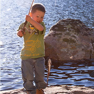
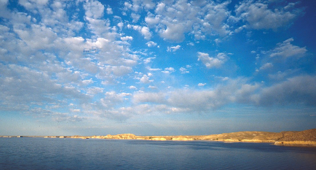
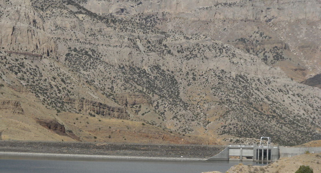
Bring your fishing rod and license for the Boysen Reservoir. At 19,500 acres, the reservoir is one of the largest in the state. It provides excellent fishing for walleye and rainbow trout, particularly in the spring. Other species of sport fish include cutthroat trout, brown trout, sauger, perch, crappie, ling (and odd looking member of the cod family), largemouth bass and lake trout.
 Fish & Camp Boysen Reservoir State Park
Boysen Reservoir wurde 1951 erbaut, um Bewässerungswasser für 100.000 Acres Ackerland bereitzustellen. Der See und die umliegende Küste wurden fünf Jahre später zum Staatspark erklärt. Der Wind River fließt hier nach Norden, bevor er auf den Damm und die Wind River Canyon trifft.
You’ll find a a marina with boat rentals and fishing licenses or you can pick up a fishing license from any member of businesses in Shoshoni. For information, contact Boysen State Park (307-875-2796), located 13 miles north of Shoshoni on Highway 20.
 Um zur Westseite des Stausees zu gelangen, fahren Sie fünf Meilen westlich von Shoshoni auf Hwy. 26/789 in Richtung Riverton zur West Shoreline Drive, wo Schilder Sie zu Campingplätzen und Bootsrampen führen. Wenn Sie nicht dagegen haben, auf Schotterstraßen zu fahren, nehmen Sie die West Shoreline Drive Loop 1 zu mehreren Campingplätzen, dann zurück zur Hauptstraße eine Meile westlich des South Muddy Campground. Sie können auch Cottonwood Bay erkunden, einen beliebten Arm des Stausees, wo Bootsfahrer Wasserskifahren und Angeln genießen, und Sie können eine Decke auf dem Sandstrand ausbreiten, um die Sonne zu genießen.
Along your way, keep an eye peeled for antelope and raptors that live in this rugged high desert country. To the north lie the Owl Creek Mountains, part of the sprawling Wind River Indian Reservation. You’ll want to spend some time fishing from the rocky shoreline or taking a walk through the desert. You can also fish Lake Cameahwait (also known as Bass Lake) located just off West Shoreline Drive. West Shoreline Drive Loop 2 will take you back out to the paved road and you can drive back south to catch Hwy. 26 for a return to Shoshoni. Then, from Shoshoni, turn left at the only major intersection, the junction of Hwys. 20 and 26, driving north on Hwy. 20.
 You may be faced with a tough decision—water or rocks? Or both? On your water (left) side, as you drive the 14 miles to Boysen Dam, you will pass three pull-offs that will take you to great water recreation areas. First stop is Tough Creek campground, built on a spit extended into the lake, provides lots of water access for all. The next campground headed north is Tamarask and then Bannon; between the two lies the marina offering food, supplies, fishing licenses, etc. All of these offer camping, picnic tables, water access and boat ramps, restrooms, children’s playgrounds and more.
To enjoy the second option—rocks—you’ll head east (right) on any one of a few roads: Booneville or Tough Creek, turning north on Quin Sabe or Bird’s Eye Road. Bird’s Eye heads east then curves north, or you can take it up to Copper Mountain Road and on up into the mountain for some great rock formations and beautiful scenery. In various places throughout this area, keep your eyes peeled to the ground to find many kinds of fossils and minerals from banded iron, tiger eye, quartz an mica sheets to pegmatites (they can house other gemstones within them) and more. A great guide for the area is offered back in Riverton at Rock Solid on Main Street. Grab the book “Wyoming Rockhounding.” It’s filled with maps and directions and advice on the “big finds.”
Scenic Delights of Wind River Canyon
Back on Hwy. 20, head north to the dam and the next leg of your journey. Explore the Wind River Canyon Scenic Byway. This is where the Wind River begins carving down through rock to form the canyon. You’ll find two cottonwood shaded campgrounds on the north side of the dam: the Upper and Lower Wind River Campgrounds with great facilities as well as some of the best brown trout fishing in the country.
Enjoy the canyon geology as the river slices its way through formations from the Triassic period (208–245 million years old) to the Precambrian period (570–2900 million years old). There are only five places in the world where you can travel through 500 million years of geologic time, two in the United States. You’ll find one of those opportunities in the Grand Canyon and the other here in Wind River Canyon. Road signs mark the geologic passage.
If you drive the length of the canyon, it’s an additional 14 miles to Wedding of the Waters. Here is where the name of the Wind River changes to the Big Horn River. This conundrum was created by explorers mapping the U.S. Those mapping areas of Wyoming started at its source and named the river for the mountains from which it came. Those mapping areas of Montana and the Yellowstone River named it the Big Horn, not knowing until later that the two rivers were the same. Thus, the names are wed at the Wedding of the Waters.
You can turn around here and head back to Shoshoni. Or you can continue on to the town of Thermopolis which is a whole new adventure. Here you can schedule a high intensity whitewater raft trip through the canyon, visit a world-famous dinosaur museum and dig, or relax in the hot mineral-infused waters of the state park.
Wann immer Sie ins Wind River Country zurückkehren, sollten Sie nicht vergessen, im Fluss am Fuße des Staudamms zu angeln. Der Fluss hier bietet einige der besten Angelmöglichkeiten in der Gegend, und Sie können hier auf Zander, Regenbogen- oder Bachforellen in Trophäengröße angeln.
 Ihr Wyoming-Fischereischein ist flussabwärts gültig; ein Teil des Flusses liegt jedoch auf dem Gebiet des Wind River Indianerreservats, so dass in diesen Gebieten eine zusätzliche Reservationsangelerlaubnis erforderlich ist.
