



Pico Lizard Head, Wyoming
Si has dedicado algo de tiempo a investigar las cadenas montañosas de Wyoming, ya sabes que los Tetons acaparan las postales y que los Bighorns atraen a quienes viajan por carretera. Pero, escondido en el extremo sur de la cordillera Wind River, se alza un centinela de granito del que muchos viajeros nunca han oído hablar: el pico Lizard Head. Con 12,847 pies de altura, no es solo otra cumbre más entre las innumerables montañas de Wyoming, sino que es el pico más al noreste del Cirque of the Towers, uno de los destinos alpinos más famosos de la cordillera Wind River. Para los excursionistas, mochileros y escaladores experimentados, el pico Lizard Head ofrece la oportunidad de disfrutar de la naturaleza agreste y los espectaculares paisajes de granito que hacen que el sur de la cordillera Wind River sea extraordinario.
¿Qué es el pico Lizard Head, en Wyoming?
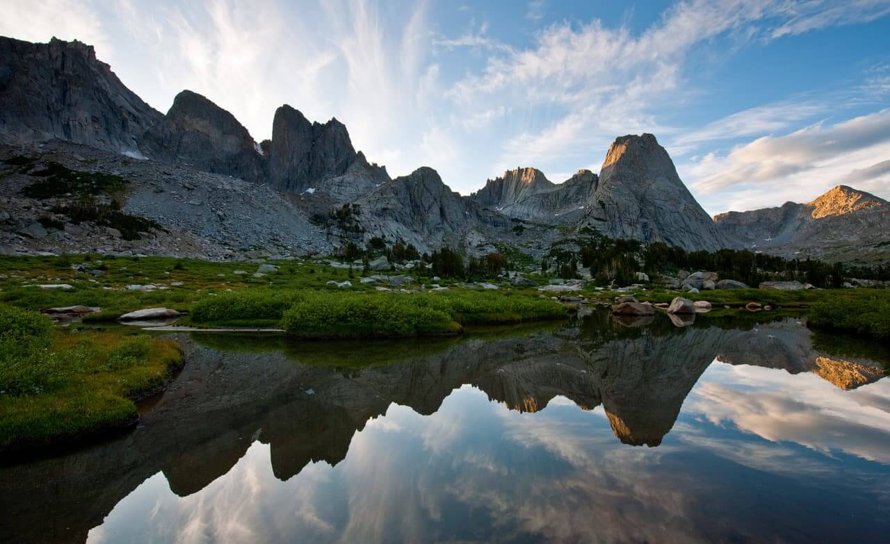
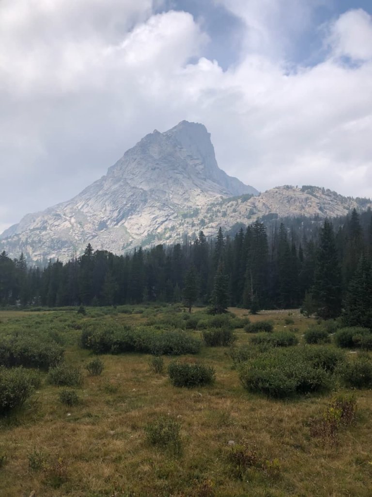
El pico Lizard Head se eleva en el interior de Shoshone National Forest y el área silvestre Popo Agie, en el condado de Fremont. Con 12,847 pies de altura, es el tercer pico más alto del sur de la cordillera Wind River y está compuesto principalmente de granito. Ubicado justo al este de la Divisoria Continental, el pico Lizard Head tiene un perfil distintivo que lo convierte en un punto de referencia reconocible desde muchos miradores al este y sureste de la cordillera.
Un pico característico de la cordillera Wind River
El perfil distintivo y escarpado del pico Lizard Head evoca el nombre reptiliano de la montaña, lo que se suma a su presencia inconfundible en el sur de la cordillera Wind River. Debajo de su cara sur se encuentran los prados de Lizard Head, un humedal de gran altitud que se inunda con las aguas de deshielo de primavera antes de dar paso a la corta temporada de crecimiento alpino. En el flanco oeste-noroeste de la montaña, el pequeño glaciar Lizard Head nos recuerda las poderosas fuerzas glaciales que ayudaron a dar forma a la cordillera Wind River.
No debe confundirse con Colorado
Aquí es donde la claridad es importante: Colorado también alberga un famoso Lizard Head, una aguja distintiva en las montañas de San Juan, cerca de Telluride. Visible desde la zona del paso de Lizard Head a lo largo de la carretera 145 de Colorado, este punto de referencia de Colorado comparte nombre con el pico Lizard Head de Wyoming, pero difiere considerablemente en su geología y características. El Lizard Head de Colorado es una aguja volcánica erosionada conocida por su roca inestable y su escalada técnica exigente, mientras que el pico Lizard Head de Wyoming es una cumbre de granito con rutas de escalada establecidas en el sur de la cordillera Wind River. Si tu marcador de GPS o los resultados de búsqueda te llevan al suroeste de Colorado, asegúrate de que se trata del Lizard Head correcto antes de planear tu viaje.
Ubicación en la cordillera Wind River
La cordillera Wind River se extiende aproximadamente 100 millas a lo largo del centro-oeste de Wyoming, formando una de las cadenas montañosas más extensas y espectaculares del estado. El pico Lizard Head se encuentra en la sección sur de la cordillera, una zona caracterizada por imponentes agujas de granito, lagos alpinos y extensos espacios naturales. Aunque destinos como el cercano Cirque of the Towers atraen a excursionistas y escaladores de todo el mundo, la ubicación remota de la cordillera y sus vastas zonas silvestres ofrecen una experiencia montañera claramente salvaje.
Donde los vientos del sur se encuentran con el circo
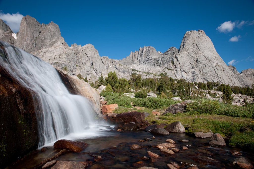
La parte sur de la cordillera Wind River alberga el Cirque of the Towers, una espectacular cuenca esculpida por los glaciares y rodeada de cumbres escarpadas, entre las que se encuentran el pico Pingora, Wolf’s Head, el pico War Bonnet y, en su extremo noreste, el pico Lizard Head. El Cirque, uno de los destinos alpinos más famosos de Wyoming, atrae a excursionistas y escaladores expertos de todo el mundo, que acuden para disfrutar de sus imponentes paredes de granito y sus clásicas rutas de escalada.
Las Torres de Granito y el glaciar Lizard Head
El paisaje circundante incluye algunas de las formaciones graníticas más distintivas del Cirque of the Towers, entre ellas Watch Tower, Block Tower y Pylon Peak. Junto con las numerosas agujas y cumbres del Cirque, crean el espectacular horizonte por el que se conoce este rincón de la cordillera Wind River. A aproximadamente un tercio de milla al oeste-noroeste del pico Lizard Head se encuentra el pequeño glaciar Lizard Head, enclavado en el terreno alpino de gran altitud al norte del Cirque.
Cómo llegar: Puntos de partida de los senderos y acceso
Llegar al pico Lizard Head requiere un verdadero esfuerzo de montaña: no hay miradores ni acceso por carretera a la montaña, y descubrir esta parte de la cordillera Wind River implica recorrer a pie un terreno alpino accidentado.
Entrada al sendero Big Sandy
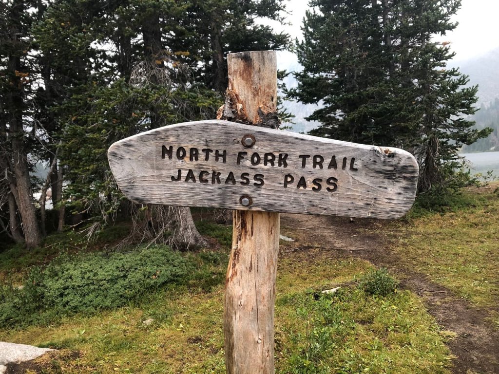
Uno de los principales puntos de acceso a la parte sur de la cordillera Wind River y al Cirque of the Towers es el inicio del sendero Big Sandy, ubicado a unas 54 millas al sur de Pinedale. Desde el inicio del sendero, los excursionistas pueden seguir una extensa red de senderos hacia el campo que rodea la zona, incluida la popular ruta hacia el lago Big Sandy y el paso Jackass, que conduce al Cirque of the Towers. Las rutas de excursión con mochila más largas pueden incluir destinos como el paso Washakie, el paso Hailey y la meseta Lizard Head. El punto de partida en sí es remoto, y gran parte del trayecto se realiza por caminos de grava y tierra, por lo que los visitantes deben planificarse adecuadamente antes de adentrarse en la zona silvestre.
Qué esperar durante la aproximación
Para la mayoría de los visitantes, la mejor forma de explorar esta zona es mediante una excursión de mochilero de varios días. El Cirque of the Towers se encuentra a unas 10 millas del inicio del sendero Big Sandy; la ruta atraviesa terrenos boscosos y alpinos antes de ascender hacia Jackass Pass y descender hacia el Cirque, cerca de Lonesome Lake. Desde el lago Big Sandy, los excursionistas ascienden unos 1,500 pies en el tramo previo al Cirque, con tramos de terreno empinado, rocoso y expuesto.
Se trata de una zona remota y aislada con poca o ninguna señal celular, y el clima puede cambiar rápidamente. Las tormentas eléctricas del mediodía y la tarde son motivo de especial preocupación durante el verano, por lo que los excursionistas deben planificar sus recorridos por zonas expuestas en consecuencia y estar preparados para cambiar de planes cuando las condiciones se deterioren. Está prohibido acampar a menos de un cuarto de milla del lago Lonesome para ayudar a proteger el frágil entorno alpino de la zona.
Senderismo cerca del pico Lizard Head
Pico Cabeza de Lagarto Se puede recorrer como parte de varias rutas de senderismo más largas que atraviesan el sur de la cordillera Wind River, conectando pasos de alta montaña, mesetas alpinas y cuencas lacustres con el Cirque of the Towers.
La travesía de la meseta de Lizard Head
Cruzar la meseta de Lizard Head es uno de los puntos destacados de varias rutas circulares de senderismo con mochila por la zona. La meseta, cubierta de tundra, alcanza una altura máxima de aproximadamente 11,864 pies y ofrece amplias vistas del pico Lizard Head, el lago Bear y los picos circundantes de la cordillera Wind River, al sur. Aproximadamente 5.5 millas de la ruta discurren por encima de la línea de árboles, a una altitud promedio de unos 11,500 pies, lo que deja a los excursionistas muy expuestos a los cambios climáticos. Los excursionistas deben revisar cuidadosamente las condiciones climáticas, planificar los tramos más expuestos para las primeras horas del día y evitar adentrarse en la meseta cuando haya amenaza de tormentas eléctricas, ya que hay muy poco o ningún refugio a lo largo de este tramo de gran altitud.
El Lago Solitario y más allá
Al descender de la meseta de Lizard Head, el sendero se adentra en los prados de Lizard Head antes de continuar a través del bosque y los prados hacia el lago Lonesome. A aproximadamente 10,166 pies de altura, el lago se encuentra dentro del Cirque of the Towers, rodeado por algunos de los picos y agujas de granito más impresionantes del sur de la cordillera Wind River. Desde aquí, los excursionistas pueden cruzar el paso Jackass Pass y continuar hacia el lago Big Sandy y el inicio del sendero Big Sandy Trailhead para completar el circuito.
Escalada al pico Lizard Head y al circo glaciar
Para los escaladores técnicos con experiencia, el pico Lizard Head es uno de los muchos objetivos desafiantes de la zona del Cirque of the Towers. Las rutas de granito del pico implican escalada técnica en roca, una exposición considerable y la necesidad de orientarse en terreno alpino remoto, mientras que el Cirque que lo rodea es reconocido internacionalmente por su gran concentración de rutas clásicas de escalada.
Rutas y nivel de dificultad
Escalar el pico Lizard Head requiere habilidades técnicas de escalada en roca y no debe confundirse con el senderismo o la escalada sin equipo hasta una cima. Las rutas establecidas incluyen escalada expuesta de varios largos, y los escaladores deben estar preparados para una orientación compleja y un descenso en un entorno remoto y silvestre. Los picos y formaciones cercanas, como el pico Pingora, Wolf’s Head y el pico War Bonnet, ofrecen objetivos adicionales de escalada de varios largos en una amplia gama de grados de dificultad técnica.
Consideraciones sobre el clima y el momento adecuado
Las tormentas eléctricas de la tarde son uno de los peligros climáticos más importantes para los escaladores en esta parte de la cordillera Wind River, especialmente en picos y crestas expuestas. Los escaladores experimentados suelen salir temprano y planean alejarse lo suficiente de los terrenos altos y expuestos antes de que se formen las tormentas. El clima puede cambiar rápidamente a estas alturas, y es posible que haya nieve y temperaturas bajo cero incluso durante los meses de verano. Los escaladores deben revisar las condiciones actuales y los pronósticos antes de salir, y llevar ropa en capas y equipo adecuados para el clima alpino, que cambia rápidamente.
Consejos para acampar en la cordillera Wind River
Acampar en zonas remotas de la cordillera Wind River requiere más planificación y preparación que un viaje típico de acampada con auto, especialmente en el terreno alpino de gran altitud que rodea el pico Lizard Head y el Cirque of the Towers.
Cómo elegir un campamento base
El Cirque of the Towers puede servir como base para excursiones de varios días de senderismo y escalada, con acceso a la meseta de Lizard Head y a rutas de escalada técnica en el pico Pingora y las formaciones vecinas. Sin embargo, los lugares para acampar son limitados, por lo que los visitantes deben tener cuidado de minimizar su impacto en la frágil vegetación alpina de la zona. Dentro del área silvestre Popo Agie, por lo general está prohibido acampar a menos de 200 pies de los senderos, lagos y arroyos designados, y se aplica una restricción más estricta en el lago Lonesome, donde está prohibido acampar a menos de un cuarto de milla de la orilla. Los excursionistas deben utilizar, cuando sea posible, los sitios de acampada ya existentes en lugar de crear otros nuevos, y deben seguir las normas vigentes del Servicio Forestal al elegir un sitio de acampada.
Normas sobre áreas silvestres que debes conocer
Dado que esta zona se encuentra dentro del Área Silvestre Popo Agie, los visitantes deben consultar las normas vigentes del Bosque Nacional Shoshone y las restricciones contra incendios antes de adentrarse en zonas remotas. En zonas con osos es obligatorio almacenar adecuadamente los alimentos; la comida, la basura, los artículos de aseo personal y otros elementos que puedan atraer a los osos deben guardarse en un contenedor a prueba de osos aprobado o mediante otro método de almacenamiento permitido. Tanto los osos negros como los grizzlies habitan en el Bosque Nacional Shoshone, por lo que es especialmente importante mantener los campamentos limpios y almacenar adecuadamente los alimentos. Las fogatas están prohibidas a menos de un cuarto de milla del lago Lonesome, y pueden estar vigentes restricciones adicionales contra incendios dependiendo de las condiciones. El uso de un hornillo de mochilero, la elección de sitios de acampada ya ocupados anteriormente donde esté permitido y el seguimiento de las prácticas de «No Dejes Rastro» pueden ayudar a proteger el frágil paisaje alpino.
Lugares cercanos que vale la pena explorar
Una excursión al pico Lizard Head puede formar parte de una aventura más amplia por el sur de la cordillera Wind River y las comunidades aledañas. Los viajeros que cuenten con tiempo adicional pueden agregar a su itinerario varias paradas de interés paisajístico, recreativo e histórico.
- Cirque of the Towers — Incluso para quienes no practican el alpinismo, la vista del Cirque desde Jackass Pass es uno de los puntos más destacados de la cordillera Wind River del sur, con impresionantes vistas del pico Pingora, Wolf’s Head y las agujas de granito de los alrededores.
- Cuencas lacustres del área silvestre de Popo Agie — El área silvestre circundante cuenta con numerosos lagos y cuencas alpinas que ofrecen oportunidades adicionales para practicar senderismo con mochila, pescar y acampar en zonas remotas.
- Lago Big Sandy — A unas seis millas del inicio del sendero Big Sandy, este pintoresco lago es un lugar ideal para que los excursionistas pasen la noche antes de emprender la subida más exigente hacia el paso Jackass y el Circo de las Torres.
- Lander, Wyoming — Para los viajeros que se dirigen a la parte sur de la cordillera Wind River desde el este, Lander es una parada conveniente antes o después del viaje, ya que cuenta con tiendas de equipo para actividades al aire libre, restaurantes, hospedaje y otros servicios para viajeros.
- Pinedale, Wyoming — Ubicada a unas 55 millas al norte del punto de partida del sendero Big Sandy, Pinedale es la comunidad más cercana que cuenta con una amplia oferta de servicios y constituye otra puerta de entrada habitual a la vertiente occidental de la cordillera Wind River.
- South Pass — Los viajeros que se dirigen hacia allí o salen por la Carretera 28 pueden alargar su viaje con una visita a la zona de South Pass, donde los sitios relacionados con la época minera de Wyoming y las históricas rutas de los emigrantes le dan un toque cultural e histórico a una aventura por la Cordillera Wind River.
Lo que distingue al pico Lizard Head de Wyoming
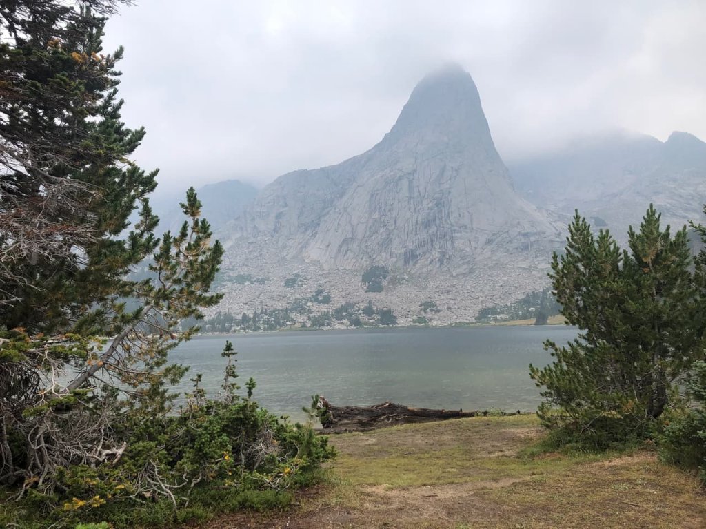
El pico Lizard Head, en Wyoming, se eleva junto a uno de los destinos de escalada alpina más famosos de América del Norte: el Cirque of the Towers. Los picos Pingora y Wolfs Head, situados en las cercanías, albergan las rutas de la cara noreste y la cresta este, respectivamente, ambas incluidas en la influyente Cincuenta ascensiones clásicas de América del Norte. Llegar a esta parte de la cordillera Wind River requiere un esfuerzo considerablemente mayor que detenerse en un mirador a la orilla de la carretera, pero el viaje recompensa a los excursionistas y a los escaladores experimentados con un extenso terreno alpino, espectaculares picos de granito y una experiencia en la naturaleza verdaderamente remota.
La mejor época para visitar el pico Lizard Head
El momento del año es importante en esta zona de la cordillera Wind River, donde la nieve puede permanecer en los pasos de montaña y en los terrenos expuestos hasta bien entrado el verano.
Condiciones de verano y capa de nieve
Por lo general, desde mediados hasta finales del verano se dan las condiciones más favorables para el senderismo con mochila y la escalada cerca del pico Lizard Head, ya que las rutas de gran altitud se vuelven más accesibles. Sin embargo, la nieve puede persistir en los pasos de montaña hasta bien entrada la temporada, y las condiciones varían considerablemente de un año a otro. Los visitantes deben verificar las condiciones actuales de los senderos, el clima y la nieve antes de adentrarse en zonas remotas y llevar equipo adecuado para las condiciones que puedan encontrar. Las tormentas eléctricas por la tarde son comunes durante el verano, por lo que es especialmente importante salir temprano al atravesar mesetas, pasos y picos expuestos.
Respuestas rápidas sobre el pico Lizard Head
¿Dónde se encuentra el pico Lizard Head? El pico Lizard Head se encuentra en la parte sur de la cordillera Wind River, en el condado de Fremont, Wyoming, dentro del Bosque Nacional Shoshone y el Área Silvestre Popo Agie.
¿Qué altura tiene el pico Lizard Head? El pico Lizard Head alcanza los 12,847 pies, lo que lo convierte en el tercer pico más alto de la parte sur de la cordillera Wind River.
¿El pico Lizard Head es el mismo que el de Colorado? No. El Lizard Head de Colorado es una formación volcánica distinta, ubicada cerca de Telluride, en las montañas de San Juan. El Lizard Head Peak de Wyoming es una cima de granito en la cordillera Wind River y es una montaña totalmente distinta.
¿Cómo se llega al pico Lizard Head? El punto de partida de Big Sandy es uno de los principales puntos de acceso a la zona del pico Lizard Head y el Cirque of the Towers. Desde allí, los excursionistas y escaladores recorren una extensa red de senderos y rutas de montaña en la parte sur de la cordillera Wind River. Llegar al pico Lizard Head requiere un recorrido considerable por zonas remotas, por lo que los visitantes deben llevar mapas y herramientas de navegación adecuadas.
¿Se puede escalar el pico Lizard Head? Sí, pero llegar a la cima es un reto de escalada técnica más que una caminata. Las rutas establecidas requieren habilidades de escalada en roca, capacidad para orientarse y sentirse cómodo en situaciones de gran exposición en terrenos alpinos remotos, por lo que la cima es más adecuada para escaladores técnicos con experiencia.
¿Cuál es el pueblo más cercano al pico Lizard Head? Para los visitantes que lleguen a la zona desde el punto de partida del sendero Big Sandy, Pinedale es la ciudad más cercana que cuenta con una amplia oferta de servicios, a unas 55 millas al norte del punto de partida. Lander es otro punto de partida útil para los viajeros que se acerquen a la parte sur de la cordillera Wind River desde el este.