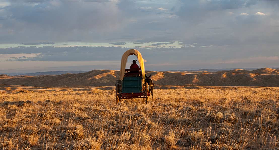
A "prairie schooner" on the old Oregon Trail. Photo: Bob Wick
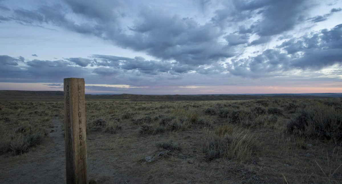
Trail marker for the Oregon and Mormon Trails. Photo: Bob Wick
The white canvas tops, or bonnets, of wagons appeared from a distance to resemble sailing ships. Photo: Bob Wick

Learn about the Oregon Trail at local museums. Photo: Randy Wise
On To Oregon!
The towering Wind River Mountains were the “Shining Mountains” that emigrant travelers on the Oregon Trail had to negotiate. The snow-capped peaks were visible for 100 miles as the covered wagon trains made their slow journey up the valley of the Sweetwater River. Finally, at the Great South Pass, the pioneers crossed the Continental Divide and entered “Oregon Country”.
See the unspoiled wide-open spaces of the Oregon Trail and some of the most pristine sections of the trail at South Pass. Or explore the Oregon Trail and its landmarks on the Sweetwater Driving Tour.
5 Places to See
Easy Access
If you want interpretation and easy access to the trails, head to Martins Cove and the exhibits along highways 287 and 220. This route provides information about the trails and can take you all the way to Casper and the BLM’s National Trails Interpretive Center.
Solitude
For solitude go to the Semino cutoff of the Oregon and California Trails. Here you can get off the beaten path, as long as you can read a map and have a high clearance 4-wheeled drive vehicle.
Adventure
For those with an adventurous spirit, the National Historic Trail off the Hudson-Atlantic City Road and the Bison Basin Road are some long sections of pristine wagon ruts.
Reenact
The section of the trail between the Sixth Crossing, or Sweetwater Station, and Rock Creek Hollow has a lot of history and numerous interpretive exhibits. This is also the location where several thousand people reenact the westward migration.
Walk-in Only
For an intimate experience, head to the non-motorized portion of the trail. The rocky ridge section of the trail is closed to motorized vehicles and you can hike or even bike the trail in this area.
My Oregon Trail Experience
When I was kid one of my favorite games to play on the computer was Oregon Trail. We’d start in Independence, Missouri and load our wagon with supplies at the general store before setting off across the country. Sometimes people would get sick. Sometimes we’d hunt and shoot a buffalo or antelope for extra food. Sometimes we’d barely win, arriving in Oregon with few people left and dwindling supplies. Sometimes we wouldn’t make it at all.
In classrooms staring at the glowing screens I’d begin to think about how hard life must have been for the people who packed up their lives and headed West. But seeing it on a computer game is nothing compared to visiting the actual trail.
Wind River Country is home to several historic trails- the California Trail, Mormon Trail, Pony Express, as well as the Oregon Trail. With so much overlap of the many historic trails that crisscross Wind River Country, the system is often called the National Historic Trail.
While all these trails span areas beyond the borders of Fremont County, Wind River country is home to some of the best stretches.
With wide open spaces of little development the view sheds in places are similar to what those pioneers would have seen in the early days. It’s still big open country and in spots there are little signs of human settlement.
“Essentially this landscape is an artifact, it is one of the only artifacts I know of that people are encouraged and allowed to recreate upon,” —Jared Oakleaf, Bureau of Land Management
The BLM’s Lander Field Office manages one of the largest intact segments of this national trail. The trail is uninterrupted in many places. It really gives a sense of what the area was like.
If you are looking to have some of the trail to yourself, visit the Semino Cutoff of the Oregon and California Trail. With a high-clearance 4-wheeled drive vehicle you can travel part of the trail. You can look at the wagon ruts and then the surrounding landscape and imagine bumping along in a wagon without the high clearance suspension of your car and navigating the never-ending prairie without roads and signs for landmarks.
To check out monuments at South Pass, which every pioneer crossed because of its ease of access, grass for grazing and water, wyohistory.org offers directions. Travel the Oregon Buttes Road, or Fremont County 445. At 2.8 miles the road curves and you can see the old wagon trail crossing Oregon Buttes Road. If the two track seems too rough for your vehicle, park and walk the three quarter of a mile to the monuments. This is the original corridor of the Oregon, California, Mormon, Pioneer and Pony Express National Historic Trails. The two track you are hiking or driving is the original wagon trail slightly modified for the modern vehicle. You’ll come upon a BLM interpretive exhibit about South Pass and a stand of monuments commemorating Narcissa Whitman and Eliza Spalding, missionaries who crossed the pass in 1836. There is also a monument to Ezra Meeker an emigrant who returned to mark and promote protection of the Oregon Trail.
These are the kind of stops I love to visit. There is something about seeing the names and the markers in the middle of nowhere that is a reminder about the people who traveled this vast landscape.
Another great stop on the trails is between Sweetwater Station and Rock Creek Hollow, Oakleaf told me. There are numerous monuments and interpretive exhibits. This is also where several thousand people re-enact the westward migration each year. It’s an almost startling site to suddenly see people making their way across the plains as though in a modern migration.
There’s other ways to enjoy the trail as well. You can camp along the trail. One of the best ways to experience the trails is to mountain bike. Start at the Rocky Ridge section of the trail that is closed to motorized vehicles.
Visitors Centers
Dubois Chamber of Commerce
Dubois, WY
Lander Chamber of Commerce
100 N. 1st St.
Lander, WY
Riverton Chamber & Visitor Center
1075 S. Federal Blvd.
Riverton, WY
Shoshoni Chamber of Commerce
216 Idaho St.
Shoshoni, WY
Sinks Canyon State Park Visitor Center
3018 Sinks Canyon Rd.
Lander, WY
U. S. Forest Service Visitor Center
333 E. Main St.
Lander, WY
US Forest Service Visitor Center
1403 W. Ramshorn
Dubois, WY