


By John Gookin
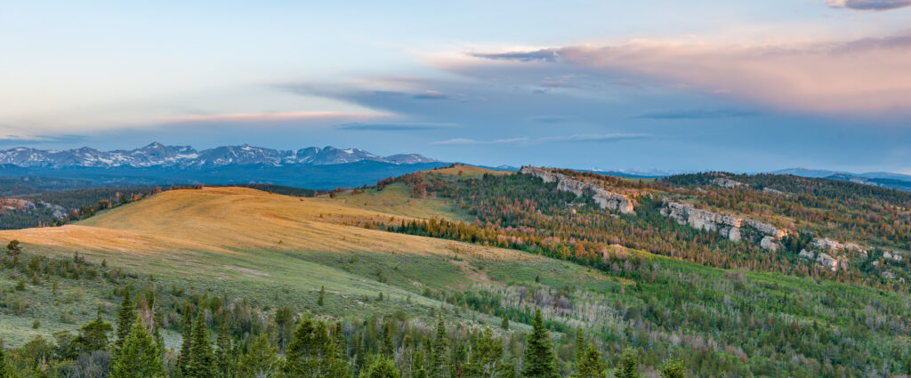
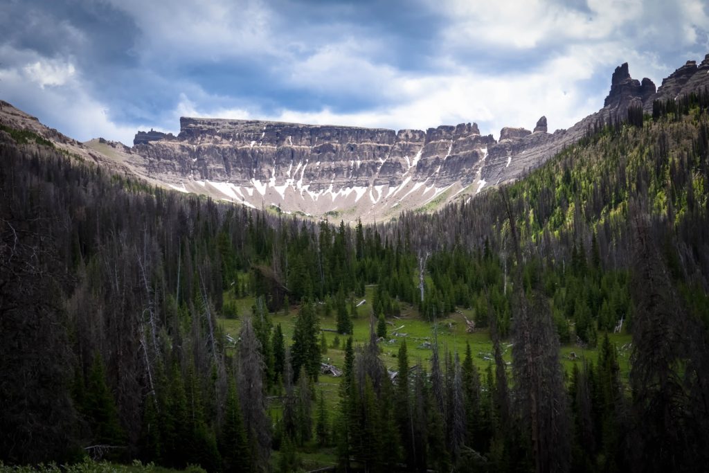
The Wind River Basin is an outdoor mecca. It is about 100 miles wide by 200 miles long and bounded by Wyoming’s highest mountain ranges. It includes half of America’s first national forest (the Shoshone), is next door to the world’s first national park (Yellowstone) and is near the United State’s first national monument (Devil’s Tower). The Wind River is fed by about 100 glaciers in the Wind River Range (The Winds), heads south, then cuts north through Wind River Canyon where the river name changes to the Bighorn River. The Wind River Basin is the home of NOLS, the International Climbers’ Festival and offices of most conservation groups and state and federal land and wildlife agencies in Wyoming. It also includes the Wind River Indian Reservation, home of the Eastern Shoshone and Northern Arapaho tribes. Rugged, raw, diverse and beautiful, the Winds are a paradise for outdoorsy types. Here are a few things to do in the widely swinging seasons in the Winds.
Spring
Check out Sinks Canyon State Park.
Location: 42.7470° N, 108.8132° W Elevation 6,122’
This is one of the most popular state parks in Wyoming. It has world class climbing, fishing, hiking, mountain biking and natural history.
Don’t miss these things:
- The Sinks: the whole river drops into a sinkhole. Walk out onto the overlook and learn about the geology that makes Sinks Canyon home to annual geology field camps for universities.
- The Rise: the river bubbles back up through the ground half a mile downriver; but it isn’t the whole river. Some of the sinking water comes up at The Rise, but not all of it. Other water that doesn’t drop into The Sinks is mixed in. Scientists figured this out using dye tracing. Check out the huge fish in the pool at the Rise. Bring some quarters to buy some fish food to drop to these monster trout. If you spend some time at the little oasis around The Rise you might see some cool birds like magpies or animals like muskrats.
- Check out the climbers: you can hike up to watch the rock climbers from a safe distance, but please don’t walk underneath them for safety reasons. Better yet, watch them with binoculars.
- Hike the self-guided nature trail between The Sinks and The Rise.
- Go fly fishing: Early spring is a great time to fish the river before the snowpack meltwater starts to flood things in May.
- Hike one of the trails: there are many trails in this canyon and the trail conditions vary with the seasons. Be careful of ice in Spring: if you make a plan and start hiking a trail, then find slippery ice, do like the locals and just turn right around and hike somewhere else.
- Camp out: you can reserve a campsite or yurt in the state campground. You can use a paid site in the US Forest Service campground, or you can use the free USFS dispersed camping site further upriver (across the road from where the USFS keeps their horses). If you’d rather be in Lander, you can always camp in Lander City Park for free (south end of 3rd Street).
- Learn to rock climb.
- Attend the School of Hard Rocks at the U/MO Geology Field Camp.
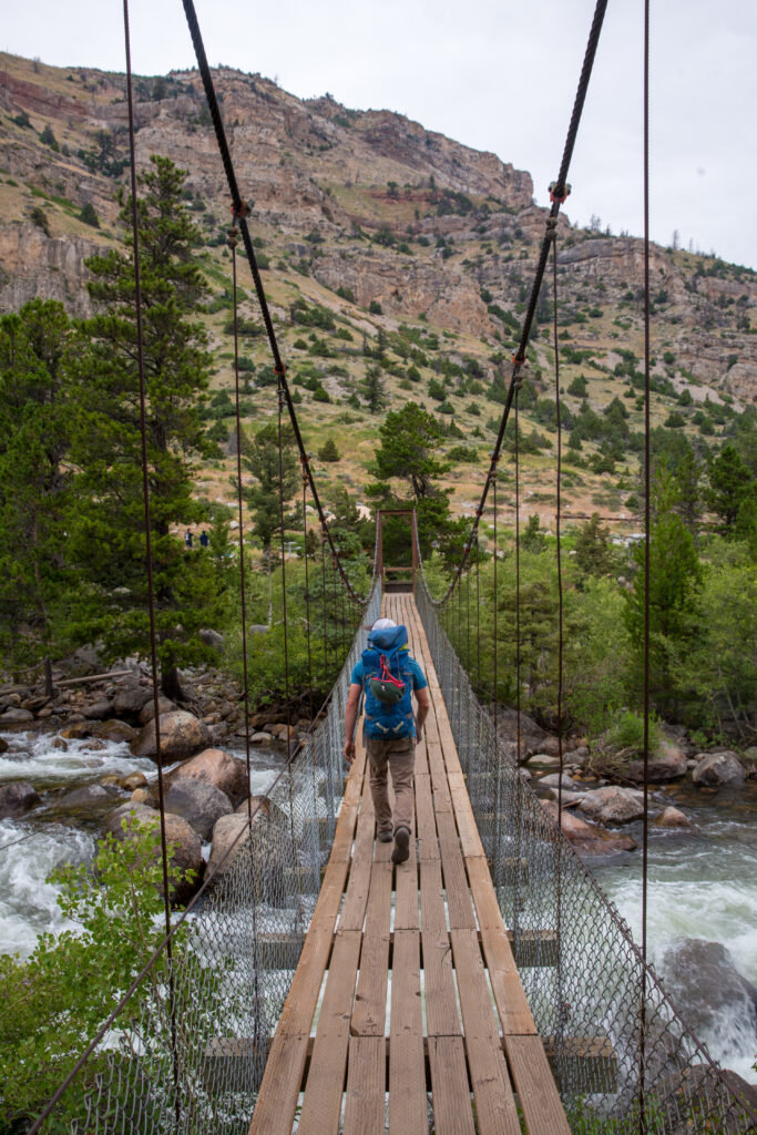
Summer
Hike from Trail Lake to Lake Louise
Safety: bear spray is carried by many hikers in this area
Intensity: moderate 5 mile hike (round trip), with a 1,000’ elevation gain, at max altitude of 8,500’, the hike takes about 2.5 hours.
The Wind River Range is huge, roughly 100 miles long by 50 miles wide. This is one of the shortest hikes that shows you some of the big granite peaks.
Access: the long gravel road is well maintained (by rural Wyoming standards), but you can also camp in this valley and hike multiple trails.
Sideshow: this valley has amazing petroglyphs.
For more hiking information, visit https://windriver.org/experience/hiking/.
Alternate: Hike to Bonneville Pass
Safety: this is the heart of the Greater Yellowstone Ecosystem with breeding grizzly bears. Bear spray and proper bear protocol are necessary.
Intensity: Easy to moderate 2.6 miles each way with an 800’ elevation gain, the hike takes about 2.5 hours round trip. You’ll rarely see other people on this hike, but you might see elk, bears, deer or other wildlife as you hike up this valley that overlooks the Dunoir Valley from the pass.
Sporty option: If you don’t mind hiking off-trail and climbing steep hills, turn north (left) at Bonneville Pass and hike up on top of the Buffalo Plateau. It is spectacular.
Details: https://www.alltrails.com/trail/us/wyoming/bonneville-pass-via-du-noir-trail.
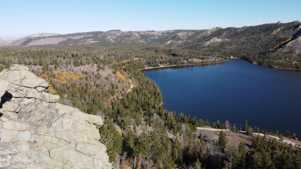
Fall
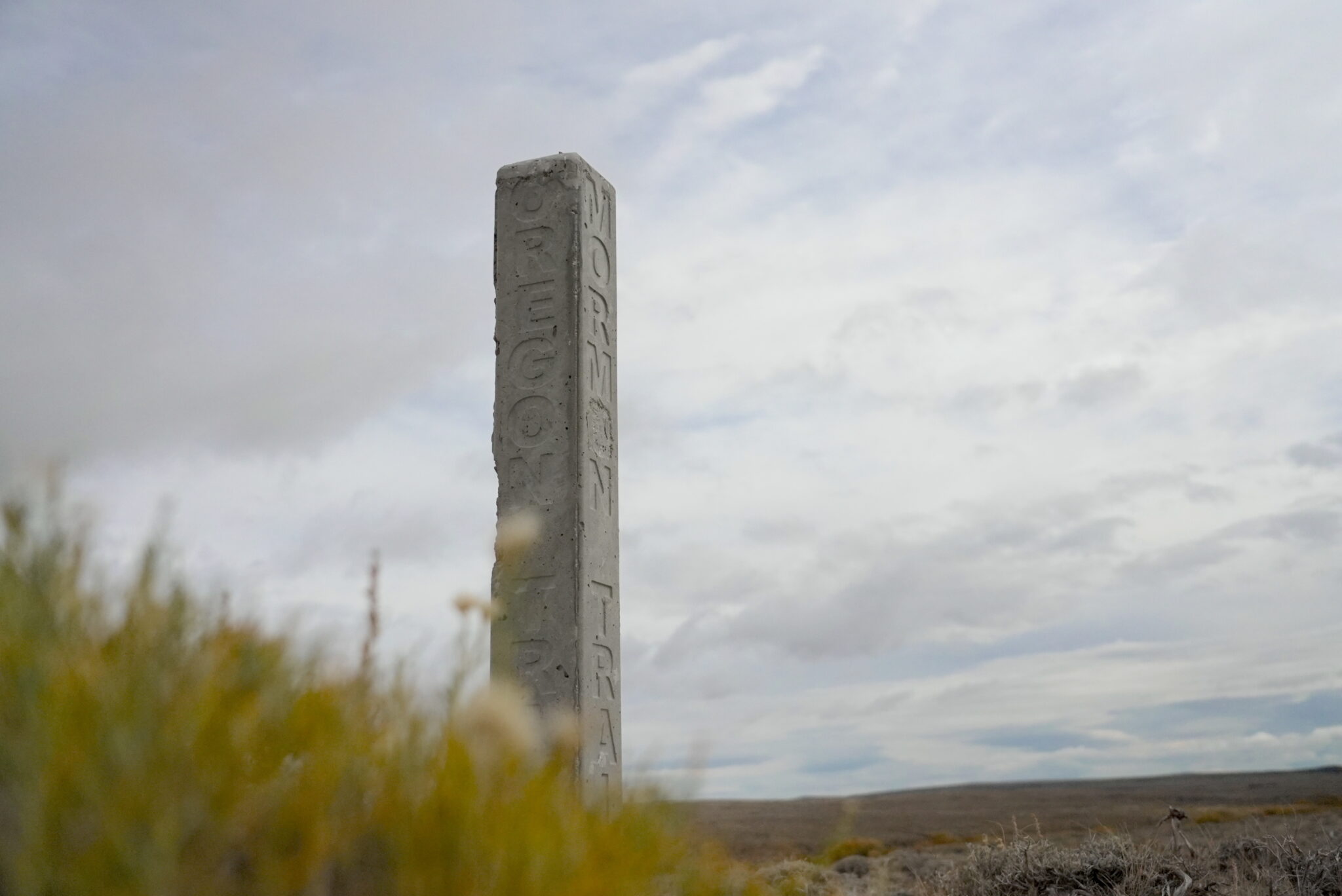
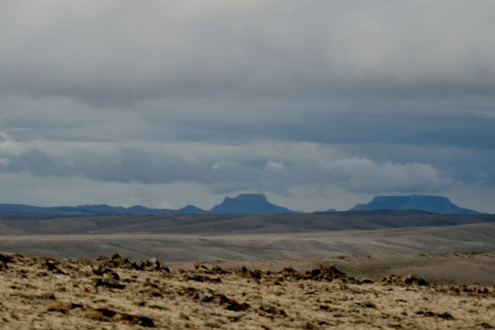
Climb the North Oregon Butte
Location: 42.25570° N, 108.856° W Elevation 8,612’
Safety first: The top of this butte is an extremely high lightning risk if there are thunderstorms within 10 miles of the location. If lightning is present, save this hike for another day. Cell phone coverage is poor or non-existent.
Intensity: easy walk up a steep hill.
Season: Fall or summer works great. Spring might work sometimes, but there could be lingering snowdrifts in the washes.
Time of day: You’re going to the wide open Red Desert. Wind is created by differential heating of the atmosphere, so in general there is less wind at night and in the morning. As the sun heats the air, the wind gets stronger and stronger through the afternoon. Go earlier in the day if you don’t want howling desert winds.
Desert driving tips: locals habitually gas up the car and load a bunch of drinking water before they leave town, just in case a shortcut turns into a long adventure. Cell phones will work better on high ground than in low areas. If you just have one bar and your calls are dropping, try texting. Gravel roads are fine in any weather. Some dirt roads get slick when it rains. In spring there may be snowdrifts in low spots. If your GPS sends you down a “road” that is literally two tire tracks through the sagebrush, consider staying on the well traveled roads.
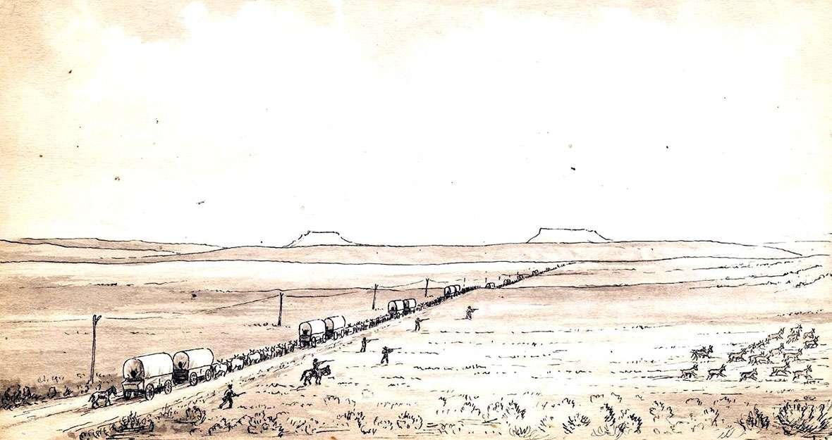
History: The two Oregon Buttes were prominent landmarks for settlers heading westward on the Oregon Trail and the Mormon Trail. They saw these buttes just as they were crossing the Continental Divide. This sketch of them was made by William Henry Jackson in 1866. Learn more about this history at:
https://www.wyohistory.org/encyclopedia/oregon-buttes-landmark-oregon-trail.
Geonotes: look for small pieces of petrified wood along the short unmaintained road between Oregon Buttes Road and the actual butte.
Driving directions and more information can be found at www.summitpost.org/north-oregon-butte/314961.
Winter
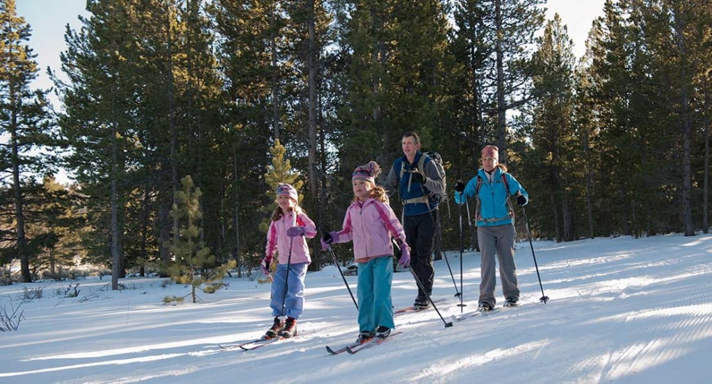
Nordic Skiing: cross country skiing at Beaver Creek
Location: 42.56057° N, 108.71399° W Elevation ~8,000’
Season: There’s usually a good ski base from January through March. Later season has longer, warmer days. For more information, including information about the (huge) high school ski races at Beaver Creek each year, as well as Beaver Creek Ski Etiquette, visit the Lander Nordic Ski Association’s website.
Beaver Creek Nordic Ski Area: Located just 25 minutes outside of town, the Beaver Creek Nordic Ski Area is a great place to explore if you’re looking for long winding trails through the trees, expansive views and a little bit of elevation. The trails are located on USFS and BLM land. Enjoy 15 kilometers of groomed trails ranging from green (easy) to black (difficult). Don’t forget to stop by the Yurt for a quick respite from the cold.
If conditions are windy in the Beaver Creek parking lot, it is highly advisable to walk under the bridge and get up onto the trail system before making a decision. Typically, on the most windy day it is remarkably calmer once you get into the trees and further out onto the course.
Choose your challenge: trails are rated from green (easy) to black (hard) and these maps can help you plan your adventure, https://www.landernordic.org/beaver-creek-nordic-ski-area.
Dogski? No doggies at BC! The Beaver Creek Nordic Ski Area was developed by locals who are fairly competitive skiers. They groom trails for classic and skate styles. Animal tracks (and snowshoes) mess up the ski tracks. If you like to ski with your pet, you should check out the nature trails in Sinks Canyon. Park at the end of the pavement (Bruce’s Camp in winter) and walk downhill along the river for easy access to these ungroomed but pet-friendly trails.
Rent cross country skis at Gannett Peak Sports https://www.gannettpeaksports.com/, (307) 332-2926.
Webcam: see what the weather is doing up there on this webcam www.wyoroad.info/Highway/webcameras/WYO28LimestoneMtn/WYO28LimestoneMtnAll.html.
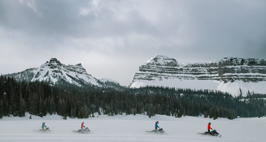
Snowmobiling on Togwotee Pass
The Wind River Basin has 600 miles of groomed snowmobile trails and a long season. The Continental Divide Trail system starts in the Wind River Basin and heads north. Bring your own sleds or rent sleds locally. Guided trips, snow lodges and western hospitality are available, but the main reason you see the Wind River Basin in most snowmobile catalogs and websites is the great snow and amazing mountain scenery, www.sledwyoming.com.
Altitude: Our atmosphere has 21% oxygen, but the air density decreases as you rise in altitude. So, when you are at 10,000’, you have the equivalent of 14% oxygen. Your body can adapt to higher altitudes by increasing the hemoglobin in your blood cells: this happens within a few days, is pretty good in a week and is no big deal a month later. When you first come from sea level, expect to be limited by the thin air.
Adapting to altitude: You can adapt better if you are careful to stay hydrated, regularly eat a few simple carbohydrates, even if you lose your appetite and pace yourself; generally avoid alcohol but maintain your regular caffeine habits.
This website has a chart that tells you the effective oxygen level for different altitudes: https://wildsafe.org/resources/ask/altitude-safety/oxygen-levels/.
