


By Shelli Johnson/YourEpicLife.com
I am a Wind River Country “local.” And a blessed one at that. For every Saturday, or Sunday, or evening for that matter, we locals have the opportunity to have a vacation experience.
The list of how we can do this is very long, and I don’t have time, or an unlimited word count to provide you with all of them. But I am going to provide a step-by-step itinerary for how you can experience one of the many possible “epic days in Wind River Country.” This one is a popular one for my family and I, especially when we have relatives or friends visiting. We usually enjoy this epic day several times in one summer.
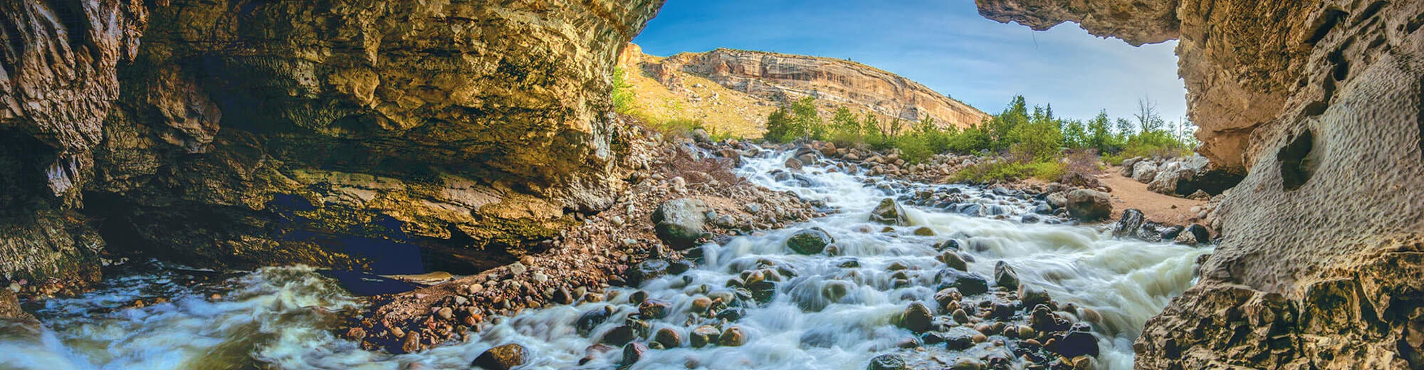
Today’s adventure includes driving a 70-mile scenic loop. This is so much more than a drive, though, and as a result, it will take you one full day to maximize your experience. You will drive through Sinks Canyon, up the steep switchbacks into the mountains, past several high mountain lakes. Then, you will join up with Highway 28 and an area called South Pass, before returning with a view of the wonder that is Red Canyon.
For best results on today’s adventure, you will need a 4WD vehicle.
- Wake up before sunrise. Drink some coffee and have breakfast, or pack it for the drive. Pack lots of water, a lunch, and some snacks, including the staples for s’mores. For what my family calls “epic s’mores,” bring marshmallows, graham crackers, and chocolate bars with almonds in them, and/or and/or Reese’s Peanut Butter Cups. Our boys also like to occasionally (definitely on Easter) use Peeps instead of marshmallows.) The only thing my family loves as much as s’mores is bacon. We also recommend taking some leftover bacon to include in your s’mores. You’re welcome.)
- Leave Lander at 8 a.m. and drive on WY Hwy. 131 South toward Sinks Canyon State Park.
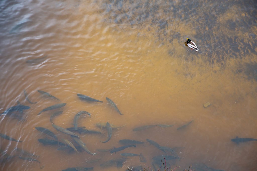
- After driving for approximately six miles, stop at The Rise, located on your right, to see, and feed, a bunch of trout. The Rise is a large pool where the Popo Agie River reappears after sinking into the limestone cavern at the “Sinks” a quarter mile upstream. There is no fishing allowed here, so don’t be tempted by the many big trout. You may feed them, though, which kids in particular love to do. There is a fish food vending machine nearby that takes quarters and dispenses handfuls of fish pellets. The trout roil the water rushing to the food. Magpies and ducks compete for the tasty treats.
Fish at the Rise. Photo: Wyoming Office of Tourism - Next, look for the paved walking path that goes up canyon and crosses the road and take this short walk to the Visitor Center. Before going into the Visitor Center building, take the short walk above to the overlook, or down toward the large limestone cavern that the Middle Fork of the Popo Agie River is entering. This caverns gets its name, “the Sinks” because the river enters the cave and goes underground until it emerges a quarter mile downstream, at the Rise, where you just fed the fish.
- After seeing the Sinks and exploring the wonderful Visitor Center, get back in the car and continue up the road, which parallels the river. Up high on your right along this stretch are some limestone cliffs that beckon rock climbers throughout the year and attract climbers from all over the world.
- At the end of the canyon, you’ll drive over a bridge that crosses the river, and you’ll see the Bruce’s Bridge trailhead parking lot. (Notes: For your convenience, there is a restroom here in the parking lot. You’ll have another opportunity near Fossil Hill Parking area in about five miles up the road. The Popo Agie Falls hike, and other wilderness destinations can be accessed from this trailhead.
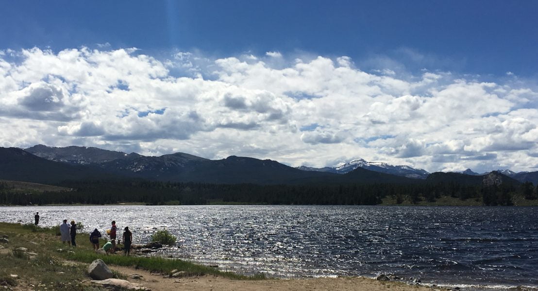
- Continue driving up the switchbacks, which provide beautiful mountain views as you gain elevation. From Bruce’s Bridge parking lot and trailhead, it is a six-mile drive to reach Frye Lake. Stop at Frye Lake to get out and stretch your legs. The big mountain in the background is Wind River Peak, which stands 13,197 feet tall and is the tallest mountain in the southern Wind River Range. Here, skip rocks! Our family loves to walk along the shore and skip rocks at Frye Lake. If you have kids and they don’t know how to skip rocks, teach them. This is one of my favorite things to do at any lake. We like to have contests over who can generate the most skips. For you more adventurous types, my brother loves to take polar plunges, so he recommends swimming to the small island.
Skipping rocks at Frye Lake. (Photo by Shelli Johnson, YourEpicLife.com) - Do you have a 4-wheel-drive vehicle, or at least a vehicle with a very high clearance? I hope so. Because today I recommend that you continue up the the mountain in the form of a dirt mountain road. (If you have a luxury sedan, you might want to turn around here.) About one mile past Frye Lake, the pavement ends, and there is a fork. You can continue straight, or take a right. If you take a right, you’ll drive about two miles on a pretty rough road to Worthen Reservoir, which is a great place to fish, picnic, canoe, or camp. Many hiking and backpacking and other backcountry adventures starts here at the Worthen Meadows Trailhead. From here, trails leads to Roaring Fork, Leg Lake, and Stough Creek Lakes Basin from one trailhead, or you can take another trailhead to Sheep’s Bridge to join up with the Middle Fork of the Popo Agie trail and other trails. I recommend that for now, you make a mental note to return here another day.
- For today, I recommend continuing straight instead of taking this right and staying on what is now referred to as the Loop Road, for approximately five more miles, to the Blue Ridge Lookout trailhead. So after five miles or so, be watching for a Blue Ridge Lookout elevation sign on your right, and an undeveloped parking area on your left, across the road from the aforementioned sign. By the way, you are at about 9,600 feet elevation at this point, so if you haven’t already, drink some water please. From here, get out of the car and pack some water and a lunch or snack and enjoy the half-mile hike to Blue Ridge Lookout. A fire lookout was built on the outcrop by the Civilian Conservation Corp in 1938 but is gone now.
- We like to climb the steps to the lookout and have a picnic lunch. (My husband and I have also enjoyed many
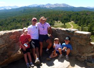
Enjoying a picnic – and panoramic views – on the Blue Ridge Lookout. (Photo by Shelli Johnson, YourEpicLife.com) romantic sunsets from the lookout with a cheeseboard and bottle of wine.) Whether you’re eating or not, take some time to enjoy the panoramic views, which include the Wind River Mountains, the Owl Creek Mountains, and much of the Wind River Basin.
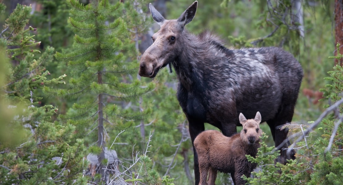
- After your return hike to your car, continue up the road for about two miles, and you’ll see Fiddlers Lake on your right. I love this lake. It has lily pads floating on some of it, and I have seen moose here, or right past Fiddlers Lake on too many occasions to count. Your best chances of seeing moose, however, will be around dusk or dawn.
- Soon after passing Fiddlers Lake, you’ll see the Christina Lake Trailhead on your right. This is another great trailhead, which provides access to Upper Silas Canyon and all of its lakes (Lower Silas, Upper Silas, Tomahawk, and Thumb, and some smaller lakes up high), as well as to Christina Lake and Atlantic Lake, and other high mountain lakes. Make a mental note to return to hike to and fish some of these lakes on another day.
- Continue driving, eventually crossing the Little Popo Agie River and traveling about one mile before reaching Louis Lake. Pronounced “Lew-ee” Lake, there are picnic areas, and campgrounds. (The Louis Lake Forest Service Guard Station and Lodge are also by the lake. Built in 1937, the lodge offers cabins, boat, bike, and fishing equipment rentals.) The lake is at an elevation of 8500 feet. Rainbow, brown, and brook trout are all in the lake, as are mackinaw. I suggest parking in the main parking lot area and walking to find one of Louis Lake’s sandy beaches. Here is where we recommend you make some s’mores. S’mores are always epic, but they’re particularly epic when made and snarfed while at this beautiful lake that is a favorite for locals.
- Once on the road again, travel about five miles to/through the large Grannier Meadows, named for Emile Grannier, a gold miner in the region.
- Next, after you’ve traveled 36 miles From Lander, or after about 27 miles since Bruce’s Bridge parking area, you’ll reach the end of the Loop Road and arrive at WY Hwy. 28. From here, we recommend you take a right and travel eight miles to explore the historic South Pass City. South Pass City is a state historic site that is listed on the National Register of Historic Places. South Pass is one of the most authentic and complete historic sites in the country! Founded in 1868 when gold was discovered here, the town quickly became the largest in Wyoming Territory with over 2,000 people and 300 buildings. Unfortunately, the boom was short lived, and the town was nearly abandoned. Today there are 29 historic buildings on the site, most fully restored inside and out and open to the public. These include the Carissa Saloon, the old schoolhouse, the general store, houses, the hotel and jail. During the summer the site is open from 9 a.m. until 6 p.m. and a small admission fee is charged. There are other ghost towns in the area including Miners Delight and Atlantic City, as well as many Oregon Trail sites.
- Hopefully you have more food to eat by now, otherwise, stop at the Atlantic City Mercantile for a greasy burger, fries and – if you’re not the driver and you’re 21 or older, a cold beer) Then return to Hwy. 28 and head back toward Lander.
- About 18 miles before Lander, you’ll be treated to the grand views of the rim of Red Canyon, a large exposure of Chugwater Sandstone. The spectacular cliffs’ red color come from oxidized iron in the formation. The canyon is especially colorful in the morning or evening as the late afternoon sun lights up the red rock.
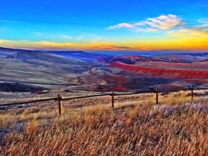
Red Canyon. (Photo by Shelli Johnson, YourEpicLife.com) - Once back in Lander, consider your cup full. You have experienced an amazing day in Wind River Country.
Shelli Johnson, owner of Epic Life, is an entrepreneur, life and leadership coach, leadership development facilitator, keynote presenter, writer, adventurer and guide. She is married to Jerry, and is the mother of three sons, Wolf, 16, Hayden, 14, and Fin, 9. They live in Lander, WY, where they frequently hike in the foothills and mountains of the Wind River Range. #WindRiverCountry
